- hello@chalets-lesgets.com
- +33 450 79 75 22
- See Summer Site
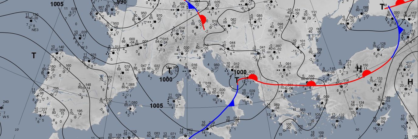
We've given you a few of the Les Gets weather forecasts we use below. Please note that more than about 2 or 3 days ahead they are not very accurate, and sometimes contradict each other!
Looking for Les Gets webcams? Please click here.
You may actually find a more detailed and accurate snow forecast at this link below. It is the forecast for Chamonix; but in our experience it's a more accurate forecast than the Les Gets specific ones!
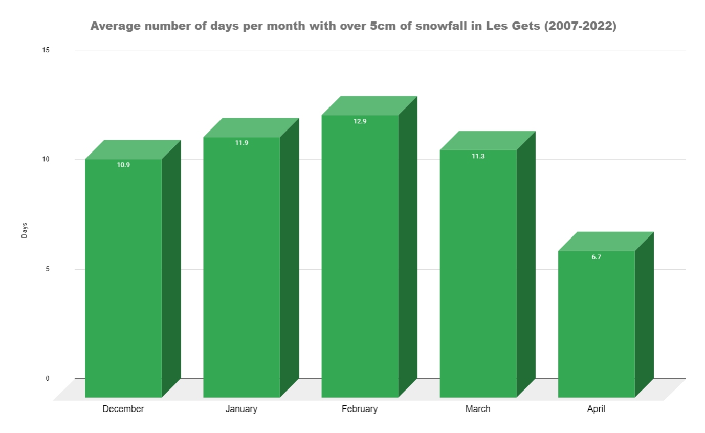
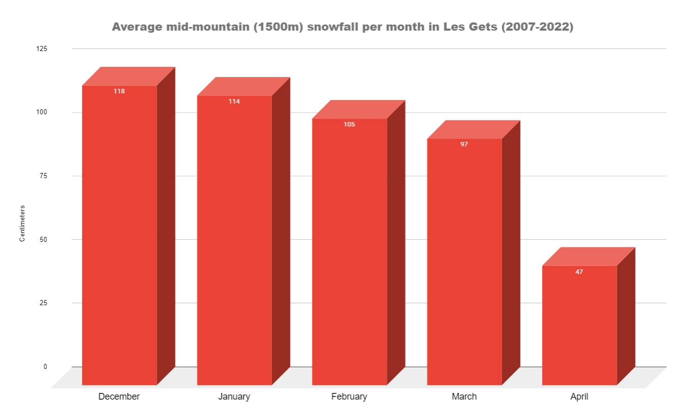
January, February and March are the coldest months of the year in Les Gets with February being the coldest. January and February are also the months with the lowest rainfall and the highest snowfall. Below is a series of tables and charts which show the historical average snowfall for Les Gets.
| Month | Mid mountain snowfall | Over 5 cm of snow | Bluebird days |
|---|---|---|---|
| December | 104 cm | 10.9 days | 5 days |
| January | 118 cm | 12 days | 8.3 days |
| February | 105 cm | 14.5 days | 7.9 days |
| March | 102 cm | 12.2 days | 4.5 days |
| April | 46 cm | 7.1 days | 1.3 days |
The number of days per month with over 5cm of snow falling in Les Gets. This data is taken from from 2007 to 2022.
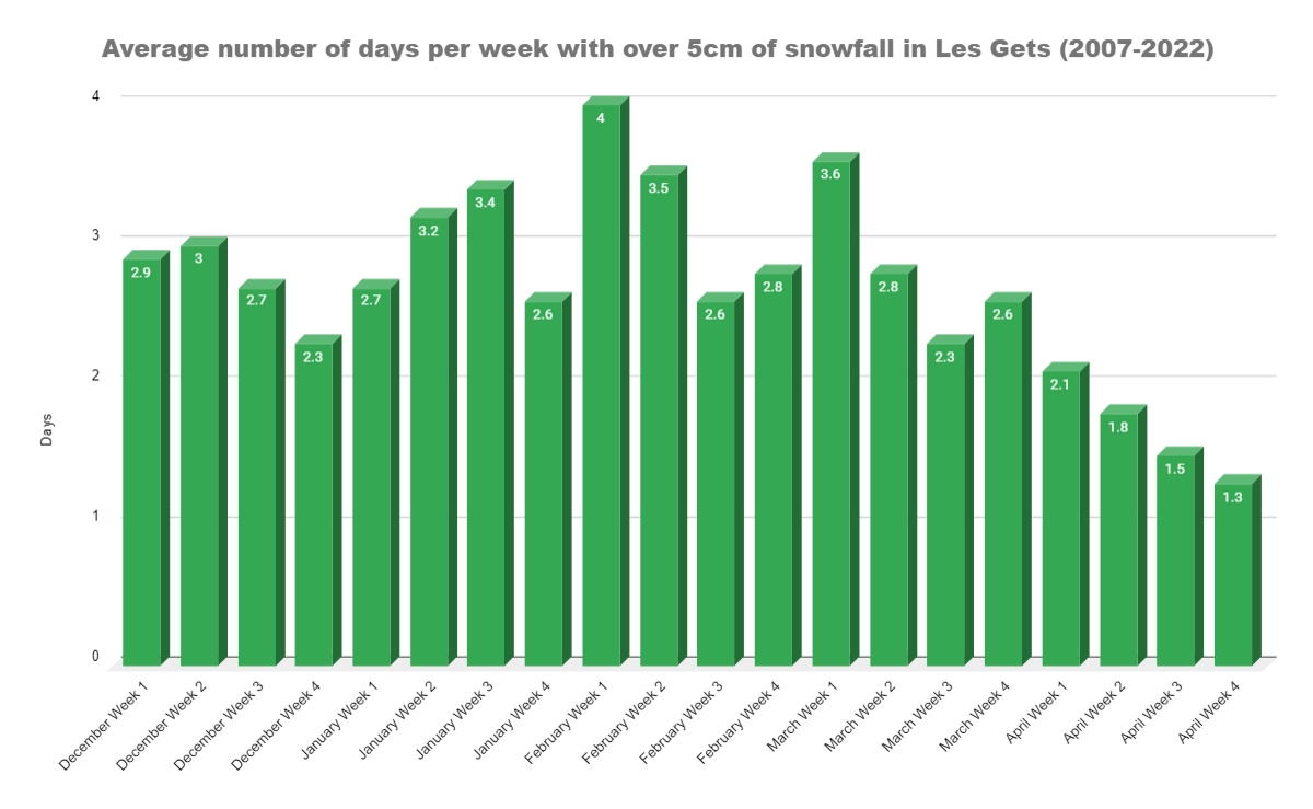
The number of days per week with over 5cm of snow falling in Les Gets. This data is taken from from 2007 to 2022.
The average mid mountain (1500m altitude) snowfall per month in Les Gets. This data is taken from from 2007 to 2022.
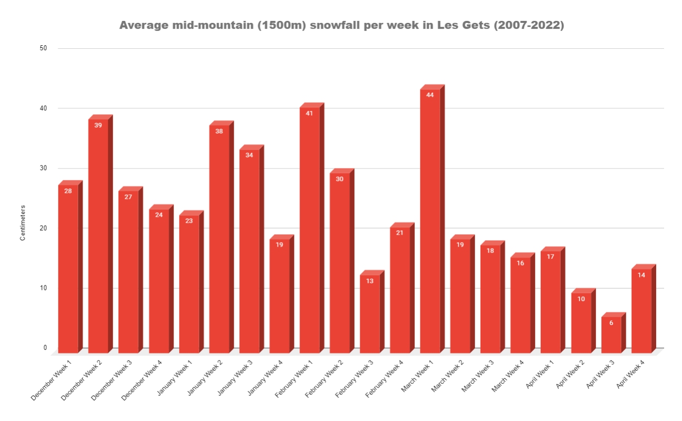
The average mid mountain (1500m altitude) snowfall per week in Les Gets. This data is taken from from 2007 to 2022.
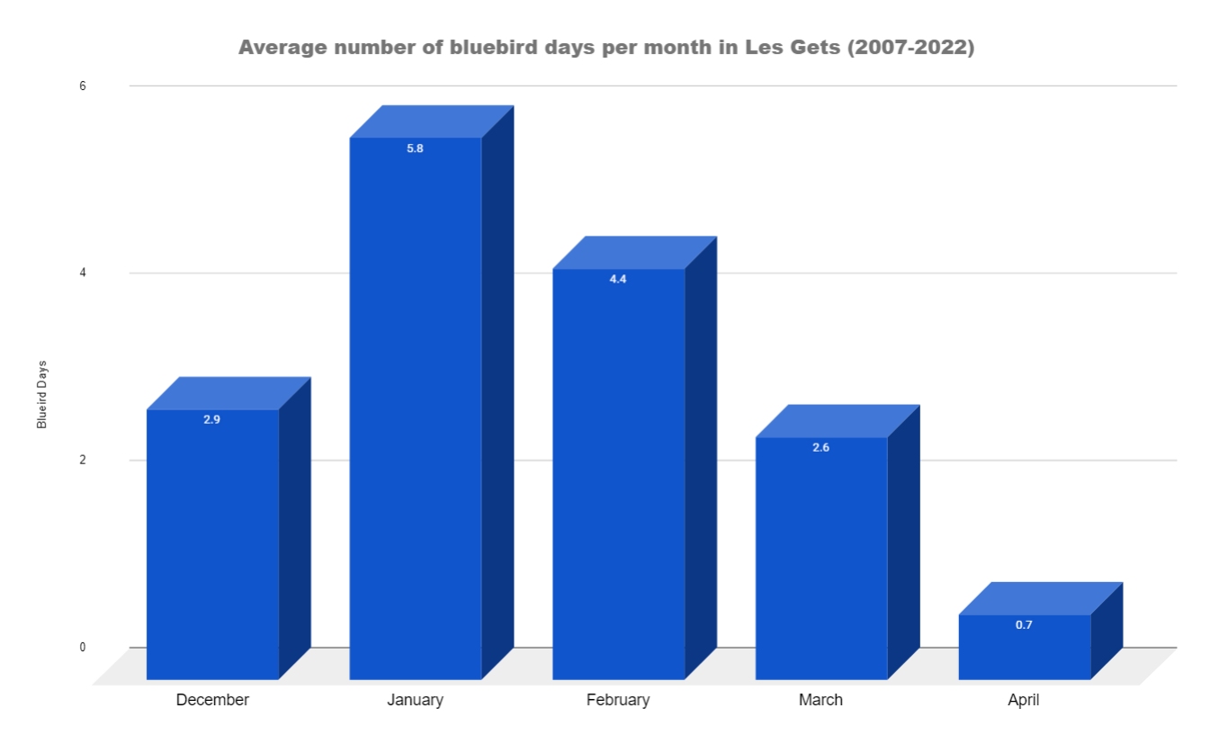
The average number of bluebird days per month in Les Gets. This data is taken from from 2007 to 2022.
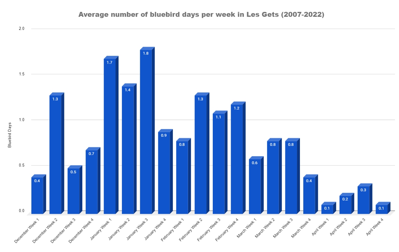
The average number of bluebird days per week in Les Gets. This data is taken from from 2007 to 2022.
Data source: snow-forecast.com
If you are interested in a detailed analysis of the historic snowfall in les Gets you will find more information here.
Partial opening: Saturday 13th December 2025 (depending on snow conditions)
The lifts officially open full time for the season on Saturday 19th December 2026 in Les Gets.
Ski lifts in Les Gets will close on Sunday 11th April 2026. Mont Chery and some other lifts may close earlier depending on snow conditions. Skiing in Avoriaz (10 - 15 mins away & part of the same ski area) is still available after this date. Please get in touch to ask us about late-season skiing.
As always all the above is snow-dependent and could change.
Ski lifts in Les Gets open at 09:00 each day through out the season.
Ski lifts in Les Gets close anywhere between 16:10 to 17:30 depending on the lift and the time of year.